Tests in the US and Switzerland prove that the WingtraOne VTOL drone repeatedly reaches 1 cm (0.4 in) absolute accuracy. In optimal conditions, even sub-centimeter accuracy is possible. Here’s a step-by-step guide to how we did it.
First, invest in a high-resolution, full-frame camera payload and a capable drone.
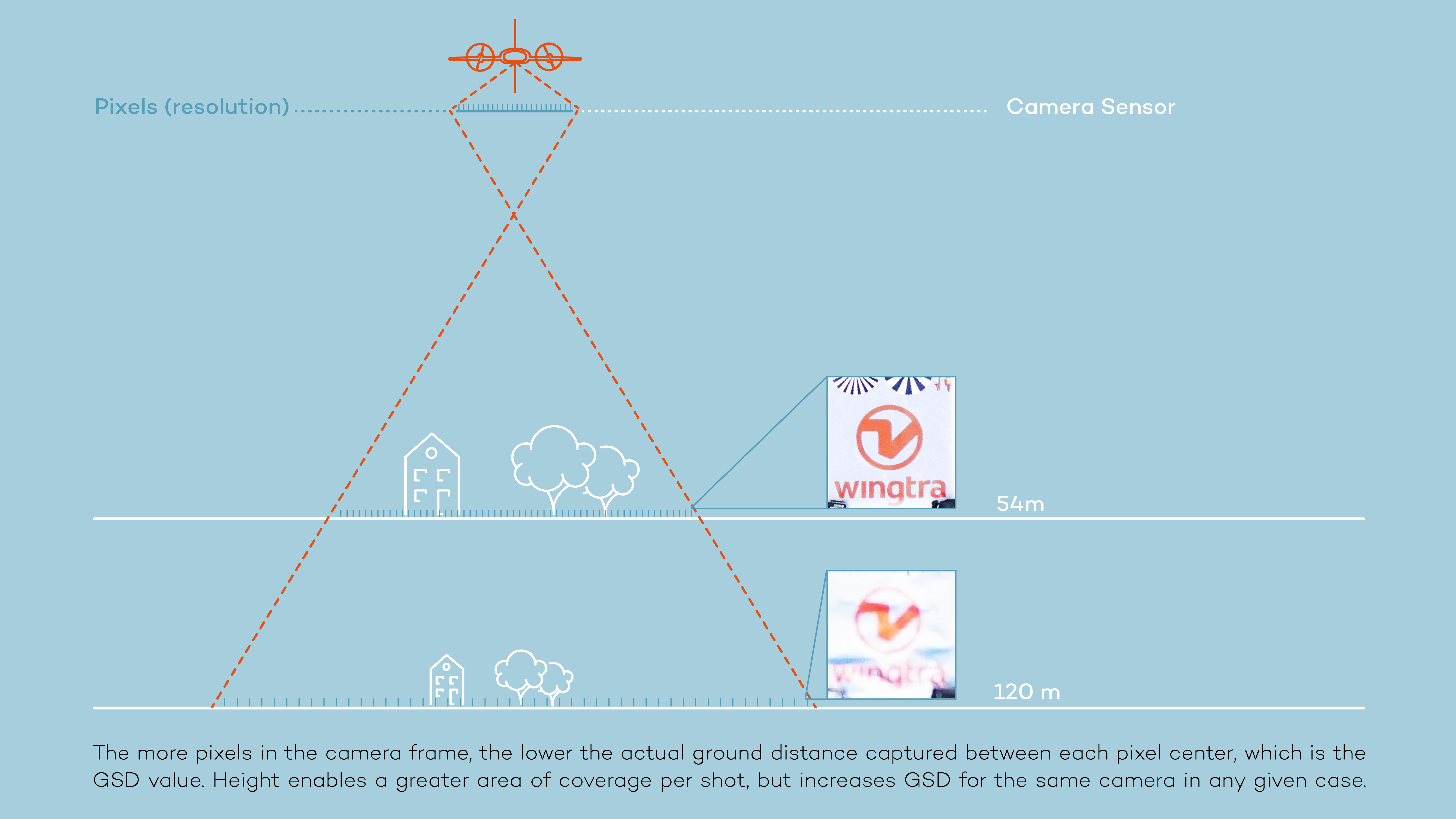
You can follow all of the other guidelines, but if your pictures don’t contain enough pixels for the area sampled at a given height, your ground sample distance will be too high for you to achieve 1 cm (0.4 in) absolute accuracy. To get ultra-high resolution and precise location information, you need a heavier and more expensive payload. You also need a drone that can take off, land and carry this payload safely and efficiently.
Next, explore the following practical resources:
Watch our video Webinar featuring Wingtra and Pix4D specialists explaining how to achieve 1 cm (0.4 in) accuracy in your next mapping project.
Read our detailed blog post featuring step-by-step guidance and helpful illustrations on how to prepare your survey for precision results.
Take a deeper look with this Wingtra white paper, Reaching 1 cm (0.4 in) Absolute Accuracy, which details data from more than 20 flights and outlines key factors influencing accuracy.
Download and assess the raw data from the Wingtra white paper.
Contact us
If you have any questions about planning your next project, contact the Wingtra team at support@wingtra.com and we will make sure to help you out!